Michael Mordini
Survey Technician

Connect with Michael Mordini to Send Message
ConnectConnect with Michael Mordini to Send Message
ConnectTimeline
About me
Geographic Integration Officer (GIO) at United States Air Force
Education

Miami University
2011 - 2013Master of Arts (M.A.) Geography
Southern Illinois University, Carbondale
2002 - 2004Bachelor of Science (BS) Land SurveyingActivities and Societies: Illinois Professional Land Surveyors - Student Chapter Treasurer

St. Norbert College
1994 - 1998Bachelor of Arts (B.A.) HistoryActivities and Societies: Football and Track & Field
Experience
McClure Engineering Company
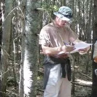
Aug 2001 - Jan 2006Survey Technician• Operated total station and GPS equipment• Maintained field book• Established vertical control for multiple surveying applications• Researched courthouse documents to ascertain history of land ownership as well to determine municipal easement rights• Interpreted survey plats to reestablish property corners• Interpreted building plans for construction stakeout surveys• Established control for and ran topographic, ALTA, and construction surveys

Southern Illinois University
Feb 2003 - Aug 2004Teaching Assistant• Conducted hydrographic surveys for erosion studies in Kinkaid Lake State fish and Wildlife Area and Crab Orchard National Wildlife Refuge• Established control, and collected and processed coordinate data for invasive species study of in Giant City State Park, IL• Instructed basic surveying techniques to students during lab portions of surveying classes• Created computer generated and manually-drafted topographic maps for erosion studies

US Army (National Guard)
Apr 2004 - Apr 2012Enlisted Soldier• Instructed classes for over fifty soldiers and officers • Advised ten soldiers in career counseling• Inspected health and welfare for ten soldiers• Issued daily duties for ten soldiers• Monitored the safety and wellbeing of ten soldiers• Performed duties as a scout truck commander on over 100 convoy logistics patrols• Conducted the conveyance of cargo to Forward Operating Bases throughout Iraq• Planned convoy routes using satellite imagery • Used intelligence received from U.S. and coalition forces for the planning of convoy operations• Briefed senior officers on procedures prior to convoy logistics patrol missions• Utilized GPS, map interpretation, and dead reckoning skills to traverse both land navigation courses, as well as hostile environments• Operated as a member of a team to ensure the safety of all team members during combat patrols• Maintained crew vehicle valued at $500,000 and attained 100% mission effectiveness for the entirety of Iraq operations • Adapted quickly to continuously changing conditions and missions • Conducted interior and exterior base security as well as convoy missions Show less
Fetters Thien Land Surveyors
Jan 2006 - Jul 2006Survey Technician• Operated total station and GPS equipment• Worked as a team member for mortgage inspections• Read and interpreted survey plats, and building plans• Collected field data in a variety of environments• Processed field data using AutoCAD LDD• Interpreted and applied construction plans in the field • Established control for and ran topographic, ALTA, and construction surveys

GIS Dynamics
Mar 2008 - Nov 2008GIS Analyst• Conducted field work using Trimble GPS receivers for Dayton Street light Inventory Project• Used ArcMap and ArcCatalog to developed GIS maps for interactive web applications• Integrated traditional survey equipment and practices into a GIS asset inventory accounting for areas that were inaccessible to satellite coverage

Michigan Technological University
May 2012 - May 2013Research Intern• Produce land cover and land use change maps from National Land Cover Datasets (USGS), Coastal Change Analysis Program (NOAA), and Crop Land Data Layer (NRCS) for entire state of Maine • Develop Land cover map of New Brunswick Canada utilizing Landsat 5 data• Analyze Synthetic Aperture Radar (SAR) data for wetland classification map of Maine and portions of New Brunswick, Canada• Conduct field research in Maine and Canada in support of NASA Gulf of Maine Project.• Write field reports• Present scientific results and methods to MTRI Staff• Write scientific results and methods in a peer review publishable format Show less

Miami University
Aug 2012 - May 2013Graduate Teaching Assistant• Re-develop existing lab assignments to ensure student comprehension and academic integrity• Grade student labs and papers and quizzes for GIS and Python classes• Facilitate evening lab hours to assist students with GIS concepts and procedures• Assist Miami’s GIS Coordinator with classroom instruction• Troubleshoot both lab assignments and ArcMap 10.1 GIS software
Three Valley Conservation Trust
Nov 2013 - Jun 2014Stewardship Technician• Repair and organize existing shapefiles and tabular data for TVCT’s conserved easements• Produce multiple easement maps for federal and state conservation programs• Conduct annual site surveys of conserved easements and write annual report consisting of maps, pictures and on site notes • Instruct interns on mapping procedures and insure quality of produced map products
Hamilton County Engineer
Jun 2014 - Aug 2016GIS Specialist• Create and maintain graphic and attribute layers in CAGIS database utilizing ESRI’s Parcel Fabric Tool suite• Research, interpret and evaluate information prior to modification and update of maps to provide quality control of parcel data• Communicate effectively one on one, as well as in meetings, to maintain an effective working relationship with coworkers, other departments and the general public • Troubleshoot Parcel Fabric and CAGIS system for errors and resolve errors when possible• Produce high quality digital tax maps for the public and other departments• Read and interpret legal descriptions and surveys submitted to the auditor to establish compliance with county conveyance standards Show less
Butler County Engineer
Sept 2016 - Jan 2021GIS Specialist and Chief of UAS Operations
United States Air Force
Jan 2021 - nowGeographic Integration Officer for WPAFB
Feb 2024 - nowEngineering Technician
Jan 2021 - Feb 2024
Licenses & Certifications

GIScience
Miami UniversityMay 2013
Honors & Awards
- Awarded to Michael MordiniArmy Commendation Award (2) US Army For service during Operation Iraqi Freedom IV and IX
- Awarded to Michael MordiniPrivate First Class George Watson Award US Army Award for selfless service
Recommendations

Faisal khan
Construction Manager at Woodlands Energy Services (WoodServ)Barmer, Rajasthan, India
Mr. zwe
Consultant | Counsellor | Customer Excellence | Civic Society Engager | Modern FarmerYangon, Myanmar
Rajat kumar
Engineering @Ventura Securities 🧑💻 • Smart India Hackathon'23 Finalist (Runner Up) • Python • Nod...New Delhi, Delhi, India
James krimmel, cpa
ControllerAnchorage, Alaska, United States
Emmanuel junior arhin, meng, e.i.t., pmp®,cmrp®
MECHANICAL ENGINEERCanada
Janice fernandes
Assistant HR Manager at Elara CapitalMumbai, Maharashtra, India
Laura-alexandra popa
Architect at Convery Prenty Shields ArchitectsGlasgow, Scotland, United Kingdom
Raouf rafik
Director general FormerEgypt
Subit raj pokharel
Assistant Chief Technology Officer at KhaltiNepal
Erick muganda
.Nairobi County, Kenya
Elamir e.
Neurologist, Neurophysiology Consultant & EntrepreneurRiyadh, Saudi Arabia
Pooriua safara
Editor in Chief at Chetor.comTahran, Tahran Eyaleti, İran
Ernesto padrón
Solutions Architect- Microsoft Dynamics 365Chile
Meet gala
Student at School Of Environment and Architecture,Mumbai Ig:-meetgala_4Mumbai, Maharashtra, India
Catalina góngora
Coordinadora de Mercadeo y Eventos | Cámara Colombo China de Inversión y ComercioBogota, D.C., Capital District, Colombia
Nic spaull
Global Education, Bill & Melinda Gates FoundationCity of Cape Town, Western Cape, South Africa
Dale adams
Automotive Training Manager | Fuelling Growth Through Innovative Learning SolutionsGreater Melbourne Area
Akarsha k s
Servicenow DeveloperBengaluru, Karnataka, India
Miro z.
CIO at JMS Invest AGErlenbach, Zurich, Switzerland
Hajra ollite
Customer Support Specialist | EcoVadis Business Sustainability RatingsPort Louis, Mauritius
...