Timeline
About me
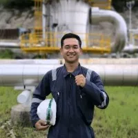
Automated Monitoring Engineer | GIS/Remote Sensing and Mining Enthusiast | K3 Ketinggian | Researcher
Education
.webp)
Universitas indonesia (ui)
2017 - 2021Bachelor's degree geographic information science and remote sensing (geography)
Experience
Badan nasional penanggulangan bencana
Jan 2020 - Jan 2020Spatial data management intern- Developed expertise in disaster information management using the WebGIS ArcGIS Online platform.- Demonstrated proficiency in creating daily maps, validating InaRISK BNPB data, and leveraging InaSAFE BNPB for predictive analysis.

Northwestern university
Jan 2020 - Jan 2020Graduate student research assistant- Proficiently interpreted and decoded soil test results for research purposes.- Conducted in-depth critical analysis of research arguments, evaluating and scrutinizing key factors to enhance the overall validity and credibility of the findings.
.webp)
Indonesian national institute of aeronanutics and space (lapan)
Sept 2020 - Jan 2021Remote sensing research intern- Conducted extensive research on oil palm plantations in Riau Province by analyzing the age of oil palm plants through the phenology of plantation land.- Developed and implemented a classification process using Machine Learning (ML) method to categorize and predict age of oil palm plantations.- Leveraged the Google Earth Engine (GEE) platform for data acquisition, processing, and visualization throughout the research workflow.- Successfully applied the findings and recommendations to enhance oil palm management practices in Riau Province. Show less
.webp)
Universitas indonesia (ui)
Aug 2021 - Jul 2022Research and project assistant- Authored three research articles on the topic of GIS/remote sensing, which have been accepted and published in respected international journals.- Provide assistance to the Research Center for Applied Geography (PPGT) in GIS/Remote Sensing research projects and other initiatives.- Undertake research-related tasks such as formulating research proposals, conducting field surveys, analyzing data, visualizing research findings on maps, developing webGIS applications, and delivering social services. Show less
Kementerian agraria dan tata ruang/badan pertanahan nasional republik indonesia
Jul 2022 - Dec 2023Individual consultant (webgis developer)- Develop and maintain ATR/BPN WebGIS dashboard using leaflet with HTML, Javascript, CSS language, Bootstrap, Geoserver, PostgreSQL, Django Python, and OpenLayers. - Verify data sent by the regional land office throughout Indonesia to then display it on WebGIS.
Pt gps lands indosolutions
Oct 2023 - May 2024Product specialist (trimble utilities solutions)
Pt telematika aset monitoring
Dec 2023 - nowProduct engineer (trimble monitoring solutions)
Licenses & Certifications

Analisis spasial menggunakan r
Grup riset geoinformatika
Ahli k3 pekerjaan pada ketinggian (level 1)
Kementerian ketenagakerjaan republik indonesiaOct 2024
Webgis appbuilder training
Pt. pangripta geomatika indonesiaJan 2019
Fullstack webgis developer course
Geocourse.idJul 2023
Recommendations

Linda janssens
Process Manager & Prevention Advisor @ TAE - Techno Automotive Equipment nvAsse, Flemish Region, Belgium
Sahra heibe
BA (Hons) English and Equality StudiesDublin, Comté de Dublin, Irlande
Salah baabbad
IT Manager at MarinaJeddah, Makkah, Saudi Arabia
Shika budhoo
Storyteller and CreativeDurban, KwaZulu-Natal, South Africa
Enrique fallas
International Business Management, Web Content, Digital Marketing, Customer ServiceAlajuela, Costa Rica
Hendra muljono
Dedicated and detail-oriented professional seeking a new opportunity in the administrative and finan...Philadelphia, Pennsylvania, United States
Francesca morelli
Consulente Protezione SocialeGreater Rome Metropolitan Area
Tarek mahgoub
Senior GIS Analyst | Senior Civil Engineer | Data AnalystGiza, Al Jizah, Egypt
Abdurrahim yıldız
Senior Procurement EngineerAnkara, Türkiye
Godswill oha
SEO Writer | Content Manager | Copywriter | Blogger | Lead ExpertAbuja, Federal Capital Territory, Nigeria
...
 Deep Enrich