Timeline
About me
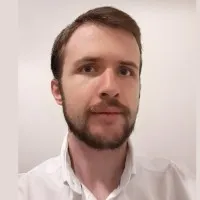
Geomatics engineer
Education

Lycée jean moulin - torcy
2015 - 2019Undergraduate of first degree computer programming, physics and mathsUndergraduate studies to enter engineering school
Ecole nationale des sciences géographiques
2019 - 2022Specialized master's degree geomatics 3 yearSpecialized Master’s degree in Photogrammetry, Positioning and Deformation Measurement (PPMD), accredited by the Conference of Grandes Ecoles (CGE), aims to train highly qualified specialists in remote sensing, photogrammetry, geodesy and metrology.
Experience

Vertigéo: la junior de l'ensg géomatique
Feb 2020 - Feb 2021Project managerVertigeo is the student organisation of the Ecole Nationale des Sciences Géographiques (ENSG) that connects professionals and ENSG's students with the aim of putting geomatics projects into practice.
.webp)
Ign - french mapping agency (institut géographique national)
Jun 2020 - Jul 2020Land survey technician5 weeks fieldwork experience with the aim of putting into practice geospatial data acquisition and pre-processing methods in GNSS, remote sensing, metrology and topometry.

Brgm
May 2021 - Aug 2021Geographic information system developerGeneralisation and multi-scale geological data mapping project
Campus mondial de la mer
Nov 2021 - Dec 2021Ocean hackathon 2021Ocean Hackathon is an annual 48 hours non-stop computer programming challenge in teams, organised by Le Campus mondial de la mer, to bring innovative solutions on actual maritime issues. Our team's challenge aim to develop mobile application called "TIK'EAU" that allows real-time aquatic species recognition into aquariums and to sea. We have won the competition organised in Champs-sur-Marne (one of the participating cities, in France) what allowed us to compete in the international pitch competition at the grand final in Brest (France) on December 15. Show less
Midgard
Apr 2022 - Oct 2022Geographic information systems (gis) developerDevelopment of a Rapid Mapping processing in satellite imagery for the firefighters's operational requirements during crisis.
Aero photo europe investigation
Aug 2023 - nowRemote sensing engineer
Licenses & Certifications

Geomatics master degree
Ecole nationale des sciences géographiquesMar 2023
Toeic® listening and reading test certification : 800 points
Ets global b.v.Feb 2023
Recommendations

Brenda pham
Human Resources Generalist at MNX Global LogisticsWestminster, California, United States
Mitali limaye
Senior Consultant at DeloitteSeattle, Washington, United States
Ary nicolas furnari
Contador Publico NacionalSan Antonio de Padua, Buenos Aires Province, Argentina
Ana-maria cirnu
Branch Manager at Trenkwalder RomaniaRomania
Matheus costa
Technical Product Owner | Low code | Agile | SQLRecife, Pernambuco, Brazil
Juan carlos pérez del castillo
Finance Transformation | Senior Manager | DeloitteMexico
Miroslav janjičić
Service technician at ATH-Heinl, IllschwangAmberg, Bavaria, Germany
Juan robles
Sales Manager at 24 Hour FitnessHaledon, New Jersey, United States
Basant tripathi, pmp®
Sr. Manager Project, Mechanical Engineer, EPC, OIL & GAS, REFINERY AND PETROCHEMICALDelhi, India
Erduan ergyun hasan
Senior Mechanical Design EngineerZwickau, Saxony, Germany
...
 Deep Enrich