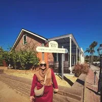
Timeline
About me
Product Manager at Group Digital, Sime Darby Plantation | Certified Professional Scrum Product Owner
Education

Universiti teknologi mara
-Msc civil engineeringFlood modelling in oil palm plantation. Skills - Hydrology modelling, hydraulic modelling, HEC-HMS, HEC-RAS, TREX, ArcGIS, QGIS, DEM, statistical analysis

Sekolah tun fatimah
1999 - 2000Spm biology, general
Utm
2002 - 2006Bsc. remote sensing remote sensing, geographical information system (gis), land survey
Experience
Uem group berhad
Sept 2006 - Mar 2007Graduate trainee(a) Attached to Group Business Development(b) Exposed to many different subsidiaries/business of UEM through assisting executive projects(c) Involve in several UEM voluntary programmes
.webp)
National university of malaysia (ukm)
Apr 2007 - Jan 2008Research assistant- Land extension monitoring using GIS and satellite images- Assist in Environmental Impact Assessment (EIA) report writing and ground work
Sd guthrie berhad
Feb 2008 - Feb 2021Vitality index project (REMOTE SENSING) - Establish, develop, and automate workflow for modified vegetation index using remote sensing data to detect general health conditions of oil palm plantation area.Vitality index project (research) (REMOTE SENSING) - Establish relationship between satellite images, vegetative measurement and nutrient on palm tree and area basis.Climate change study for Sime Darby Plantation estates in Malaysia, Indonesia, and PNG (HYDROLOGY) - Create and apply method for climate change analysis to evaluate its impact towards the estates.Basemap refinement (REMOTE SENSING, GIS, MAPPING & SURVEYING) - Establish and develop method to improve positional and attribute accuracy of existing GNSS map using hybrid approach from remote sensing, surveying, and GIS data. Semi-automated approach in the counting of oil palm trees using high resolution satellite image (REMOTE SENSING) - Invent independent programme using GIS software with the accuracy of more than 95%.River basin analysis (HYDROLOGY) - Initiate and complete river basin analysis for Sime Darby Plantation Malaysia which includes main-catchment, sub-catchment, flow direction and accumulation and river digitization.Bund profiling (MAPPING & SURVEYING) - Plan, collect and analyse data from Trimble R10 and DSM drones.Replanting blueprint for low lying area (HYDROLOGY & GIS) - Set up and implement replanting blueprint for problematic area using hydraulic and hydrology principles and geospatial data e.g. topography data.Identification of water storage area (REMOTE SENSING, HYDROLOGY, SURVEYING & GIS) - Develop method for identification of suitable area to convert problematic area to pond using a combination of remote sensing, hydrology and GIS technique with Agronomist and estate management. Show less Water management (HYDRAULIC MODELLING) - Design, plan, and coordinate ground survey with engineers and estate management in the establishment of new canal using geospatial data and related GIS and hydraulic software.Detection of bagworm defoliation using multispectral drone images (REMOTE SENSING) - Establish image processing and data sampling methods. Perform image analysis and statistical analysis using machine learning (random forest) approach.High Conservation Value Area (HCSA) Project, Belitung, Indonesia (REMOTE SENSING,GIS,LAND SURVEY) - Plan, coordinate and collect related data on-site such as the GNSS coordinate, land use analysis and verification and etc.High Conservation Value (HCV) analysis for MINAMAS, Indonesia (REMOTE SENSING, GIS) - Desktop analysis of land use classification for HCV studyEstate GNSS mapping and surveying, Malaysia (GIS, LAND MAPPING AND SURVEYING) - Responsible for 35,000 Ha of boundary, fields, roads, drains and unplanted areas GNSS mapping,GIS editing, SAP database and land title difference assessment. Flood mitigation modelling and planning (REMOTE SENSING, GIS & HYDROLOGY) - Establish method for hydrological assessment using geospatial data e.g. DEM, satellite images. Re-evaluate flood mitigation plan with engineers, agronomist, and estate management through involvement in Bund Committee. Navigation device and app (APPS) - Translate mapping data for navigation purpose on portable devices e.g. Garmin GPSmap 62s and iPAD (GAIA). Establish and commercialize the use of OziExplorer navigation app for Agronomist. Provide training for Agronomists and transfer of technology to department.Feasibility Study (REMOTE SENSING & GIS) - Develop and execute image processing methodology for feasibility study. Provide training and transfer of technology to related departments.Advanced Site Yield Potential (ASYP), Agronomy (REMOTE SENSING & GIS) - Plan, coordinate and acquire resources. Execute field verification. Show less
Chief Scientist II
Jan 2019 - Feb 2021Senior Scientist
Jan 2010 - Dec 2018Scientist
Feb 2008 - Dec 2009
Genting plantations
Feb 2021 - Jul 2022Manager - technical gis/rs
Sd guthrie berhad
Aug 2022 - nowProduct Manager
Mar 2023 - nowSenior Product Consultant (Precision Farming)
Aug 2022 - Mar 2023
Licenses & Certifications
- View certificate

Data-driven decision-making for business professionals
LinkedinJul 2023 - View certificate

Technology for product managers
LinkedinJul 2023 
Enterprise gis made easy
UdemyNov 2022
Qfield quickstart
UdemyNov 2022
Recommendations

Eduardo sanchez lopez
Lead System Programmer, VoitCuautitlán Izcalli, México, Mexico
Dr. shebin sharief
Senior Lead Research / Associate Professor/Researcher/NEC Mentor-IIT BOMBAY/IEDC/ Business Mentor/As...Idukki, Kerala, India
Stalyn quishpe solis
Machine Learning Engineer | Científico de datos | Desarrollador Senior de SoftwareEcuador
Victoria ferraro
atToronto, Ontario, Canada
Mitch czworka
Team Lead - Business Development - DarktraceDarktrace
Rafael frederigi
Gerente de logísticaBrotas, São Paulo, Brazil
Dexter f. miranda
Agricultural & Biosystems EngineerPearsall, Western Australia, Australia
Ross lewis
Vice President at NomuraLondon, England, United Kingdom
Stefano russo
Project Manager presso DBA PRO. S.p.A.Rome, Latium, Italy
Thomas more haettenschwiller
Regional Chief of Operations -- UNICEFGeneva, Geneva, Switzerland
...
 Deep Enrich